
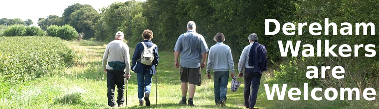
 News
News Published Walks
- Current Events
- Event History...
 ...New Routes Walk
- About us
- Path work
- Links & Supporters
- Contact
- Documents
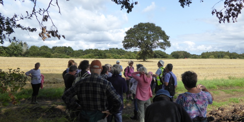
27 August 2018, New Routes Walk
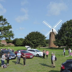
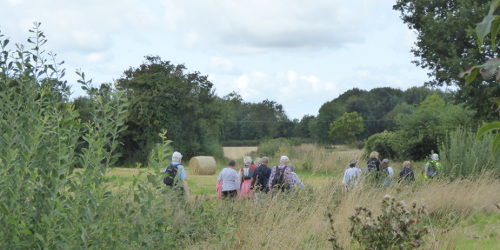
Our ‘New Routes’ walk saw 24 people assemble at the Windmill on a fine Bank Holiday Monday morning, ready to walk all 6 of the newly recognised Restricted Byways in Dereham.
Norfolk County Council have produced a map overlay showing the new routes (PDF opens in a new window). This report will reference the routes marked on the map. Throughout the walk, Ken gave the group a brief outline of 'where, how and why' these various routes gained their new status.
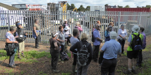
We set off along Cherry Lane (Route A), round the security fenced area soon to become housing (Route B), and over the bridge across the A47 (Route E). Turning right, we went down the track towards Tesco (Route D); this Route ends where the track turned away from the A47, though the further path is to be dedicated as a bridleway as part of the planning consent for the development of that land.
There followed a walk past the supermarkets, over the A47 slip road and then the railway, then up Greens Road. Route B follows the original Hall Lane, now sandwiched between the A47 and an industrial area:
 This section was in the poorest condition of the 6 routes we followed, being
rather narrow and overgrown (but there were blackberries!)- we wait to see what
Norfolk County Council will do to bring it into proper use. The historic Hall
Lane lies under the A47, obliterated when the bypass was built back in 1978: in
its place, we now have Route D to the south, and Route B to the north.
This section was in the poorest condition of the 6 routes we followed, being
rather narrow and overgrown (but there were blackberries!)- we wait to see what
Norfolk County Council will do to bring it into proper use. The historic Hall
Lane lies under the A47, obliterated when the bypass was built back in 1978: in
its place, we now have Route D to the south, and Route B to the north.This part of the walk ended back at the bridge, which we again crossed, this time turning east onto Route C, still Hall Lane until reaching Cherry Tree Cottage, where it joins the course of Cherry Lane. (The section of Cherry Lane west of here but south of the A47 has long since disappeared.)
We continued along Route C to its end, at a point where the supposedly existing Restricted Byway-3 starts. Unfortunately this Restricted Byway has been ploughed out for many years, with Norfolk County Council declining to do anything about it while its northern end did not join a right of way; now that Route C is established, we will be pressing for either the reinstatement of Restricted Byway-3, or an acceptable alternative route, such as the one we followed past Willow Cottage Farm and Badley Moor Farm.
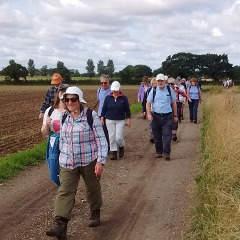
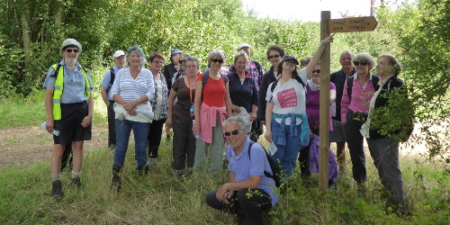
This brought us out onto the track which runs from Mattishall Road to Dumpling Green - Dereham’s longest right of way, though only as a public footpath (26). We returned most of the way to Dumpling Green, where we took a small detour to inspect the new finger post sign:
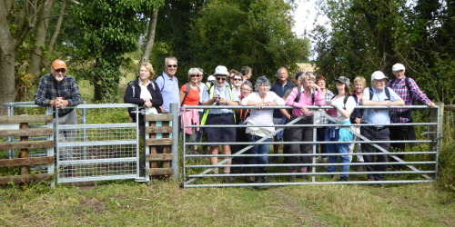
After about 100m a 'kissing gate' has been installed alongside the main farm gate giving access to Badley Moor:
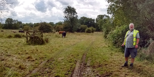
Despite the 'beware of the bull sign' at least one person went through onto the Moor to say hello to the cows:
After our brief detour we backtracked north towards Footpath 25 (formerly Green Lane, though only the bottom few metres remain the width of a lane) to rejoin Route C.
Here, some of our group decided to take the short way back to the Windmill by turning left:
 The rest of us turned right and repeated the short distance to Cherry Tree
Cottage, there turning north up Route F, the 6th and final New Route. Crossing
the A47 on the Mattishall Road, we made one final diversion, using a well used
(but yet to be claimed) track to Little Neatherd, then down Norwich Road to
Cherry Lane and back (on Route A) to the Windmill.
The rest of us turned right and repeated the short distance to Cherry Tree
Cottage, there turning north up Route F, the 6th and final New Route. Crossing
the A47 on the Mattishall Road, we made one final diversion, using a well used
(but yet to be claimed) track to Little Neatherd, then down Norwich Road to
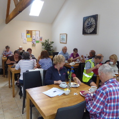
Cherry Lane and back (on Route A) to the Windmill.Pleased that the group following the shorter walk had not eaten all of the sausage rolls and cakes, we enjoyed the fine refreshments arranged by the most accommodating volunteers on duty.
Walk promotion flyer (pdf, opens in new tab).
Back to Event History